About
ARID will address shortcomings in Earth observation of drylands, realize unique new opportunities to improve remote sensing & modeling of the Earth system, and enhance management, sustainability & livelihoods in global arid lands
BACKGROUND

Drylands are highly sensitive to changes in climate and land use, and changes in drylands impact critical ecosystem services (e.g. grazing, food and fuelwood production) impacting livelihoods of ~2 billion people worldwide. These ecosystems have also experienced some of the most extreme climate in recent decades, especially in the western US, where thousand-year droughts and extreme heat waves negatively impact livelihoods and natural landscapes.
Despite their importance, these ecosystems are under-studied, and thus new research is needed to understand and mitigate dryland climate and anthropogenic changes. For numerous stakeholders, including Federal Managers (BLM, Forest Service), Indigenous Sovereign Nations, State, private and community land-managers, the ARID Field campaign will provide critically needed earth observation tools for sustainable management of the drylands of the western USA and beyond.
Drylands Cover About 40% of Global Land Area
Drylands Take Up About 40% of Global Carbon
Drylands Supply 60% of Global Food Production
ARID Pillars
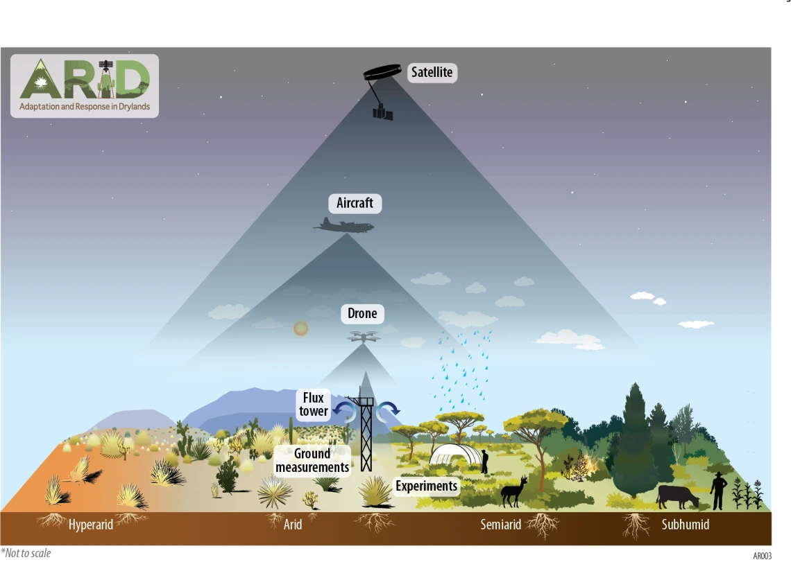
ARID will propose new field, airborne, and orbiting science programs designed to understand
Drivers of Change in Drylands
ARID will study key factors causing change in drylands, like climate variability and human activity, to understand what’s driving these transformations.
Ecosystem Responses
Using field, airborne, and satellite data, ARID will track how dryland ecosystems are responding now and predict future changes.
Impact on Ecosystem Services and Human Well-Being
This pillar will assess how changes in drylands affect resources and services essential for human well-being, such as water, food, and air quality.
Adaptive Management and Climate Mitigation
ARID will identify strategies for climate adaptation and resilience, promoting practices to strengthen dryland ecosystems and communities.
Key Questions
(1) What are the main environmental and anthropogenic drivers (e.g. increased aridity, grazing, fire regimes, precipitation variability, increased temperature, drought) of short-term dynamics and long-term change in drylands?
Image

(2) What are the processes, interactions and feedbacks that control dryland responses?
(3) What do alterations to dryland structure, composition, and function mean for the provision of ecosystem and cultural services both now and in the future?
(4) What opportunities exist for climate change mitigation and adaptation of dryland communities to future changes, and which actions will have the most impact?
Technical Approach

